Massachusetts Statutory Requirements
M.G.L. c41, §81D requires that in the preparation of a Master Plan, a planning board (and the community) shall include the following elements:
Open space and recreation element which provides an inventory of recreational resources and open space areas of the municipality, and policies and strategies for the management and protection of such resources and areas.
Here is the old open space plan, which is now defunct since August 2005:
http://www.auburnguide.com/template2.pl?id=138,56,36
In case the link evaporates mysteriously as things tend to do around the Town Hall it's under the section Home>Culture>Natural Resource Planning. Quoting from the plan:
Goal 2 To expand and improve existing open space and recreational resources and facilities.
Objectives
• Improve existing recreational facilities as per the Parks Master Plan.
• Provide a wider variety of recreational activities of people for all abilities, including expanded opportunities for hiking, biking, swimming, canoing, fishing and bird watching.
• Develop trails for both passive and active recreational use
• Develop a multi use plan for the Pakachoag Meadows and Grace Cutting Park parcels.
• Develop a trail from the Housing Authority land around the Senior Center.
• Improve accessibility of existing public open space to all segments of the community, including the addition of access easements, parking facilities and trail systems.
• Protect and/or acquire surface water bodies that provide recreational opportunities.
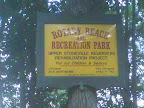
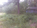
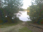
• Provide aesthetic improvements to existing parcels, particularly Gleason Park and Rotary Beach.
there's not much going on. In fact when I brought the issue of Rotary Beach up at a recent Recreation meeting, it was dismissed out of hand as unusable. It's curious that somehow the waterway has deteriorated to the point it's unusable in 2007 yet in the previous incantation of the open space plan from 2000 it was worth maintaining at least.
Well it turns out grant money requested for the new Rec director's plans for fields over on Packachoag may not be available in part because we don't have a current open space and recreation plan filed with the state. This is a requirement under the above statute to receive funds.
There are several other goals listed in the old open space plan like a nature education center, walking trails and such, all of which to my knowledge have been left aside for another time and set of people to worry about. A much greater opportunity for open space preservation, a proposed gift by a developer of an area of just under 300 acres of prime uplands on Leicester St recently received an unenthusiastic response from Planning claiming “that land is of no use to the town because we can't build on it or provide athletic fields from it”. I've walked that land and it's essentially wild, perfect for passive (ie low cost) recreation and habitat preservation. Open space is simply not a priority in town right now, thanks to a development-centered mentality. Issues of conservation are viewed mostly as a hurdle to overcome in your site planning process. There has been very little in the way of proactive conservation or passive recreation planning, although the recent Master Plan approved by town meeting did mention some goals for preservation in a general way.
Upon contacting other towns like Charlton and Millbury, a statement was made that Auburn is like the donut hole as far as conservation efforts. Surrounding towns have the Charlton Heritage Trust and Millbury has conservation land. It wouldn't take a huge effort for our town to have the same. In fact contrast that with expensive and energy intensive areas like athletic fields and there's no contest – passive recreation is far lower cost over time. The overall character of the town is intricately connected to undeveloped land also. One of the few open areas that exists for conservation is private – the Auburn Sportsman's Club. I think we should be grateful they have not sold out and cashed in all these years, but it also points to the lack of public lands available.
Open space zoning when you don't preserve it
There's another side to the open space issue namely zoning, which is somewhat controversial to some people. The idea is that planning development in tight nit clusters is more efficient, lessens the impact of sprawl on the environment and when done properly ensures more open space is preserved. There are economic benefits (better market value) also for the home owners when it's done properly. One key issue that enables this is that because we have town sewer and water we can do it. On the face of it I think this is a good idea in many ways. Given the fact that the town is relatively small geographically, the presence of several bodies of water and otherwise limited suitable land for residential building, it kind of makes sense also.
The reason people don't like it many times is that for one, things tend to get more crowded. Some folks want a large minimum lot size and like that feeling of having a large piece of land they can call their own. But this also can lead to sprawl, destruction of trees and habitat, eutrophication of waterways, increased impervious surfaces (leading to drainage issues) and higher cost for services due to less of a tax base. On the other side of it, if open space planning is done properly it should in theory add a sense of community to neighborhoods that do it as well as economic benefits due to preserved space and character.
I think the problem with this in our town is that, other than wetland areas, which are not really buildable (although they've filled plenty in, biggest example being Silver Lake/Auburn Mall), open space is not really planned for, it's what is left over. This kind of makes sense since we don't have a plan right now. The economic benefits for homeowners of open space clusters are not there unless you preserve the rest of the space from development. The result right now is houses built in areas like under power lines, in low lying gullies and ditches – spots that don't make a lot of sense. I think developers take maximum advantage of our tight zoning to fit in as much as possible. Unless and until with open space planning and clustering we actually preserve space, you just urbanize the community. Granted this is efficient in terms of delivery of services and extending the tax base; but over time, Auburn would become more and more an extension of the city of Worcester, unless we plan to preserve those things that make us a town. The hills, waterways, woods and fields of Auburn, are what gives it its character as a town and what we'll give up if we let open space planning continue without preservation or conservation.


No comments:
Post a Comment